Metadata
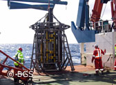
Geo-Seas populates and provides a common catalogue of available data sets, such as samples, cores and seismic survey data, managed by national geological surveys and research institutes in Europe.
To provide a detailed inventory of data sets Geo-Seas has adopted and adapted the Common Data Index (CDI) Data Discovery and Access service of SeaDataNet. This provides an ISO19115-based index to data on individual samples, cores and geophysical measurements and a unique interface to access these data sets online. The Geo-Seas data centres are connected and populate the CDI service with metadata for their data sets.
Visit the Geo-Seas Common Data Index service.
Moreover Geo-Seas contributes to the following European metadatabases, that are coordinated by the National Oceanographic Data Centres (NODCs) of SeaDataNet:
- European Directory of Marine Environmental Data sets – EDMED
- European Directory of Marine Environmental Research Projects – EDMERP
- European Directory of Marine Organisations – EDMO
- Cruise Summary Reports – CSR
These present a matrix of data-related activities. Visit these metadatabases at the SeaDataNet portal
Previously partners had developed the EU-SEASED metadata service in the framework of the EU-funded projects EuroCore, EUMarsin and EuroSeismics (1998 – 2004). This service provided an inventory of seabed samples, cores, and seismic surveys, mostly for European seas, but also for the world oceans.
Geo-Seas has upgraded and replaced the EU-SEASED service and its inventories, and has extended the functionality considerably by adding direct online data access.
Furthermore partners had developed the SEISCANEX infrastructure in the framework of the EU-projects SEISCAN and SEISCANEX (1997 – 2004). Old seismic reflection data from deteriorating paper records have been rescued by scanning the records. Over 14.000 TIFF-format images, representing 2.000.000 line kilometres of seismic survey data, were generated, and archived in databases at partners in the UK and France. The metadata is based on the FGDC (1994) standard, and images are viewable as thumbnails on a web portal.
Geo-Seas has also upgraded the SEISCANEX inventory and access to data, and has integrated the SEISCANEX data centres in the Geo-Seas infrastructure.